You spend enough time drilling in the Niagara Region and you start to notice patterns that the generic hazard maps just don't capture. The contrast between the stiff Queenston Shale up on the escarpment and the soft glaciolacustrine silts down near the Whirlpool basin is stark, and it shows up in every set of shear-wave profiles we run. A uniform UHS from a 2,475-km-away reference rock just doesn't cut it when you're dealing with a site where the impedance contrast at the overburden-bedrock interface can amplify short-period motion by a factor of two or more. That's where seismic microzonation moves from academic exercise to practical necessity. We've applied these methods on projects from the tourist district along Clifton Hill to industrial expansions in Thorold, and the site-specific spectra almost always diverge meaningfully from the default Class C envelope. A proper MASW survey to nail down VS30 is usually the starting point, and when the stratigraphy gets complicated we'll layer in seismic refraction to map the bedrock profile before running the 1D analysis.
When the impedance contrast between glaciolacustrine clay and Queenston Shale exceeds a factor of three, expect short-period amplification that the NBCC Class C envelope will miss by 30 to 50 percent.
Methodology and scope
Local considerations
The Niagara Region sits in a moderate seismic hazard zone—not Vancouver, but not negligible either—with the NBCC 2020 assigning a PGA of about 0.08g on firm ground for the 2% in 50-year hazard. What makes microzonation critical here isn't the absolute shaking level, it's the amplification trap. We've seen sites in the old Lake Iroquois plain where thirty metres of soft, high-plasticity clay overlies a sharp bedrock contact, generating a fundamental site period around 0.6 to 0.8 seconds that lines up uncomfortably well with the resonant period of mid-rise steel and concrete frames. That's a recipe for double resonance under a moderate-distance earthquake from the Western Quebec Seismic Zone. The risk gets compounded by the tourist infrastructure: hotels with irregular mass distribution, elevated walkways, and retaining structures along the gorge rim that weren't designed with any seismic consideration in the 1960s. A microzonation study identifies these hot spots before the structural engineer even sits down to model the building, and it gives the municipal reviewer a defensible basis for requiring site-specific spectra instead of the default code values. For critical facilities, we sometimes recommend seismic isolation when the microzonation results show a spectral acceleration peak that coincides with the building's fundamental mode.
Applicable standards
NBCC 2020 (National Building Code of Canada, Part 4, Division B), ASTM D4428/D4428M-14 (Crosshole seismic testing), ASTM D7400-17 (Downhole seismic testing), NEHRP Provisions (FEMA P-1050, site classification methodology), Eurocode 8 Part 1 (EN 1998-1:2004) for comparative site response approaches
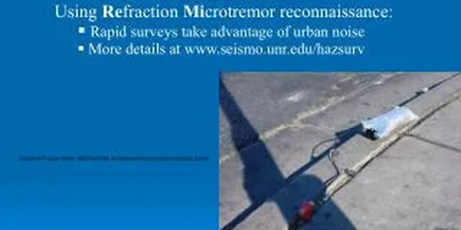
Associated technical services
VS30 Mapping via MASW and Downhole
Direct measurement of shear-wave velocity profiles using active and passive-source MASW arrays, calibrated with downhole testing in boreholes. We map VS30 across the site at 50 to 200-metre grid spacing to build a defensible site-class map for the municipality or the design team.
One-Dimensional Site Response Analysis
Non-linear and equivalent-linear modeling (DEEPSOIL, Strata) using modulus reduction and damping curves matched to the local glaciolacustrine clays. We input scaled NBCC-compatible ground motions and output surface response spectra for each representative soil column.
Basin Geometry and Deep Structure Characterization
Seismic refraction and MASW surveys targeting the bedrock surface up to 80 metres depth. In the buried St. David's paleovalley, capturing the 3D basin geometry is essential for identifying lateral propagation effects and basin-edge amplification.
Microzonation Maps and Geotechnical Reporting
Delivery of GIS-compatible microzonation layers showing PGA amplification, spectral acceleration at 0.2s and 1.0s, and site class boundaries. Reports include NBCC compliance justification, ground motion time histories, and design spectra for structural engineers.
Typical parameters
Frequently asked questions
What is the typical cost range for a seismic microzonation study in Niagara Falls?
For a site-specific microzonation covering a typical commercial or industrial parcel in the Niagara Region, costs generally range from CA$5,900 for a basic VS30 classification with MASW to CA$23,740 for a comprehensive study that includes multiple borehole shear-wave profiles, non-linear site response analysis, and a formal microzonation map deliverable. The spread depends on the number of measurement points, the depth to bedrock, and whether we need to run 2D basin models for sites in the St. David's paleovalley.
How does NBCC 2020 handle site-specific seismic microzonation versus the default site factors?
NBCC 2020 permits site-specific response analysis under Article 4.1.8.12 when the site conditions fall outside the standard Class A through E descriptions, or when the structure is post-disaster or high-importance. The code allows substitution of the tabulated site coefficients Fa and Fv with values derived from a ground response analysis that accounts for the local stratigraphy, impedance contrasts, and the soil's non-linear behavior under strong shaking. The analysis must use at least 11 ground motion records scaled to match the UHS for the reference rock condition.
What's the difference between a regional hazard map and a microzonation study?
The regional hazard maps in NBCC 2020 give you the shaking on NEHRP Class C reference ground averaged over large grid cells. A microzonation study refines that to the scale of individual parcels by measuring the actual shear-wave velocity profile at your site, modeling how the local soil column filters and amplifies the bedrock motion, and accounting for basin geometry effects that a regional map can't resolve. In Niagara Falls, where overburden thickness can change by 50 metres over a few hundred metres laterally, the difference in spectral acceleration between the regional map and a site-specific microzonation often exceeds 40 percent at short periods.
How long does a typical microzonation study take from field work to final report?
A standard microzonation project in the Niagara Falls area takes between four and eight weeks from mobilization to report delivery. The field work—MASW lines, borehole drilling with downhole seismic, and possibly refraction—typically requires three to five days on site. The bulk of the timeline is in the processing and modeling: picking dispersion curves, inverting VS profiles, selecting and scaling ground motion records, running the site response iterations, and compiling the microzonation maps. Rush schedules can compress this to three weeks when the drilling and seismic crews work concurrently.